Collier's Ferry to Lake Bayou Paddling Trail
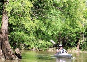
This 7-mile out-and-back loop trail gives visitors a chance to paddle through one of the remote and beautiful backwater channels of the biologically diverse Big Thicket National Preserve.
Trail Access
Collier's Ferry Park
- Type:
- Access Point
- GPS Coordinates:
- 30.1330, -94.0960
Collier's Ferry Park
5390 Pine Street
Beaumont, TX
Traveling north or south on US Highway 69/96 in Beaumont, take the Lucas Drive Exit and head east approximately 3 miles. Turn left heading north on Pine Street and continue straight just past the Beaumont Country Club to Collier's Ferry Park. Traveling west on IH-10 take the Pine Street Exit 855B and travel 2.83 miles just past the Beaumont Country Club to Collier's Ferry Park. Note: Pine Street dead-ends at Collier's Ferry Park.
Navigating the Trail
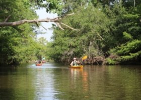
Trail Length: 7-mile loop
Float Times:~2 - 5 hours (depending on wind speed, water levels, and time spent exploring)
Trail Description
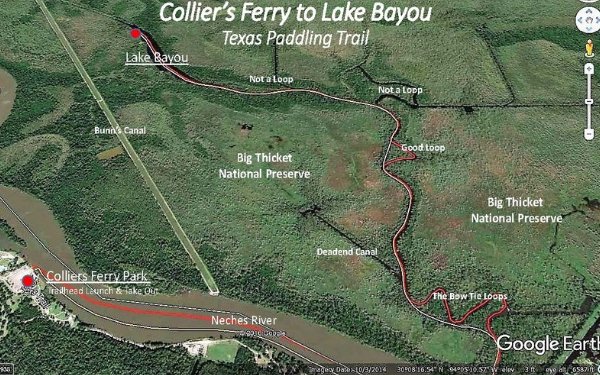
The Collier's Ferry to Lake Bayou Paddling Trail is an out-and-back loop paddling trail. It is approximately 7 miles long. Paddlers float a short distance down the Neches River to Lake Bayou and into the Big Thicket National Preserve. This trail provides a great opportunity for paddlers to experience wildlife and ecology of the Preserve. Paddlers have the option to dock their boats on some parts of the trail and walk on the banks. The trail head and take-out at Collier's Ferry Park was the main ferry crossing on the Old Jasper Road and alternate crossing on the Opelousas Trail from Liberty through Beaumont to Louisiana. It was used as early as 1750 and the route followed Indian traces and was the "highway" for explorer-settlers, priests, soldiers, trades from Spain, France, and Anglo-America. The ferry's most important use was as a cattle crossing on the famous Opelousas Trail from 1820s to 1900. Herds came this way to bypass the streets of Beaumont. Although others ran it during its 1831-1950 career, the ferry crossing took its name from the John Collier family who operated it or 50 years.
Trail Map
Things to Do and See
Fishing
The river and oxbow lakes throughout this area support both black largemouth and spotted bass. A favorite of Southeast Texas, you can also find blue, flathead (also called yellow), and channel catfish in these waters. This system is home to a variety of sunfish, along with alligator gar and long-nose gar. Small lures such as jigs, plastic worms, spinner baits and light-line are recommended. A Texas State Fishing License is required.
Wildlife and Ecology
The riparian corridor of the Neches River supports a diversity community of plant and animal life throughout the entire watershed. Birds spotted here include a large variety of migratory species including water fowl and waiting birds and song birds. An array of plants can be found along the river, including bald cypress, black tupelo, river birch and the occasional spider lily. Many reptiles and amphibians can be found in and around these waterways. Be especially cautious of the American alligator, alligator snapping turtle and water moccasin, also called a cotton mouth. If you spot any of these species, give them a lot of space and do not attempt to interact with them.
Rentals and Shuttles
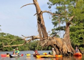
Services offered: Kayak Rentals, Canoe Rentals, Shuttle Services, Maps, Paddles, Lifejackets, Guided or Self-Guided Day Trips and Overnight Trips. Services will vary with each outfitter.
Big Thicket Outfitters
115 Connolly Road, Vidor, TX 77662
(409) 786-1884; http://www.bigthicketoutfitters.com
Eastex Canoe Trails/Eastex Outfitters
50 Turtle Creek Dr., Silsbee, TX 77656
409-385-4700; http://www.eastexcanoes.com
Partnership
This trail was made possible through a partnership between Texas Parks and Wildlife Department, Big Thicket National Preserve, Big Thicket Association, Beaumont Convention & Visitors Bureau, Lower Neches Valley Authority, and Texas Conservation Alliance.